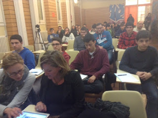
Teacher Alberto Soto of Ramis’s High School received a training in Magnolia during the first week of December in London. The stay was part of Erasmus + 2014-1-SE01-KA103-000556 project with the center. Albert believes it has been a very good experience for the quality of the training. This training can be used for giving more knowledge to their courses at the Higher Level Web Application Development.
Alberto made an exhibition of more than an hour to all Ramis’s students explaining Magnolia technology. Using his own words:


Within the world of web applications, content management systems or CMS begin to be a link between publishers and web application programmers. Although wordpress usage is increasing it does not make much sense to use a CMS of these characteristics for many integrations that wish to perform and Magnolia can offer a better integration and professional usage.
Magnolia CMS is, in that context, an abstract programming system that allows content publishers to manage an serve content in several websites easily without the need to write complex coding or having any technical knowledge. For the programmer’s point of view it assumes abstraction entirely on the web, and lets them program source on live and generate multisite websites like "1and1", create web systems and a multitude of features such as server configuration using directly a web interface.

Using that point of view, the features of the latest version of this system are presented after a training conducted under the European framework (Erasmus +) that enables less experienced developers to create high level collaborative environments.
In Betabeers also was shown a presentation of island's map coding: Beyond Google Maps. The Menorcan GoogleMaps. http://cartografia.cime.es/
With a history of over 10 years, Google has managed to democratize the use of digital maps, like no other Geographic Information System has achieved.
The JavaScript API allows you to insert Google Maps on our web pages, create high-performance applications based on description of the location or create images in 3D with Google Earth API. Google Maps API are a free service, but subjected to certain terms and conditions. But ...
- What if showing Google Maps is not what we need?
- Are there other free map sources?
- Are there other similar APIs for Google Maps that can consume other maps?
- Are there other data services with spatial component?
For an hour we will make a brief tour to major webmaping APIs that exist apart from Google maps, as well as the main features: OpenLayers & leaflet
And we discovered other source of cartographic data: OpenStreetMap, IDEs and WMS services & Data Services SDI menorca
We have learnt practical way to use alternative to Google Maps APIs to locate on our territory or that information coming from other webservices.
More information: https://betabeers.com/event/betabeers-menorca-release-17-22-01-2016-mao-3598/

Talk Contents:
Alberto http://www.albertosoto.es/learn/mgnl/#/
Marc http://cartografia.cime.es/Publicacions/Publicacions.aspx?tipo=MANU&idpub=546
No comments:
Post a Comment